
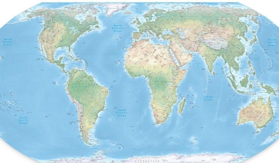

It’s a farewell to a performance almost five centuries old. The United Nations General Assembly adopted a resolution on Friday September 4 to promote a global cartographic representation more faithful to the actual size of the continents, notably enlarging Africa and shrinking the United States.
This text, supported by Togo and the African Union and co-sponsored by France, was adopted by 164 votes to one, that of the United States, and six abstentions.
The resolution aims to encourage international organizations and States to use “Equal Earth” type cartographic representations.
This cartography abandons the so-called “Mercator” projection – named after Gerardus Mercator, geographer, cartographer, philosopher and theologian born in Flanders in 1512. His world map was designed for maritime navigation and artificially enlarges the territories located at high latitudes.
A distortion which “contributes to minimizing in people’s minds the size of Africa, Latin America and South Asia, and to perpetuating an unbalanced vision” of the planet, according to the text of the resolution.
See alsoFabrice Argounès: “The meridians were used to locate oneself in the world and control territories”
“Maps shape our understanding of the world,” Togo’s Foreign Minister Robert Dussey said from the podium. “They guide education, nourish the imagination and influence collective perceptions. They are therefore never neutral: when they give a distorted image of our planet, they risk perpetuating erroneous representations transmitted from generation to generation.”
“This initiative does not target any nation, any civilization, or any cartographic tradition” but “is guided by a universal ambition: to promote knowledge based on scientific rigor, respect for the truth and the equal dignity of all people,” insisted Robert Dussey.
“Do work of truth”
“Resolutions like this, and the ideological agenda that they promote, hinder the work of this institution and contribute to the loss of its credibility,” reacted sharply the American representative Yaryna Ferencevych in the enclosure.
“Rather than focusing on the real issues of international peace, prosperity or good relations between countries, this body debates cartographic projects dating from the 16the century,” she added, urging countries to show “common sense” in rejecting the text.
France, a former colonial power, provided strong support for this resolution, at a time when it is seeking to reconnect with Africa where its influence has been significantly eroded in recent years.
In a speech given Friday at the Sorbonne, Foreign Minister Jean-Noël Barrot declared that “changing the map obviously does not change the world. (…) But correcting a representation that distorts it is already working with the truth.”
According to him, this development is consistent with the French desire to defend its own reading of international relations in the face of narratives deemed to be simplistic, whether it is the opposition between a “so-called global South” and a “collective West” or a vision of a Europe condemned to decline.
With AFP