
Hurricane Isaias Live Updates: Gulf Coast Prepares for Storm, Florida Declares State of Emergency

Rain and floods
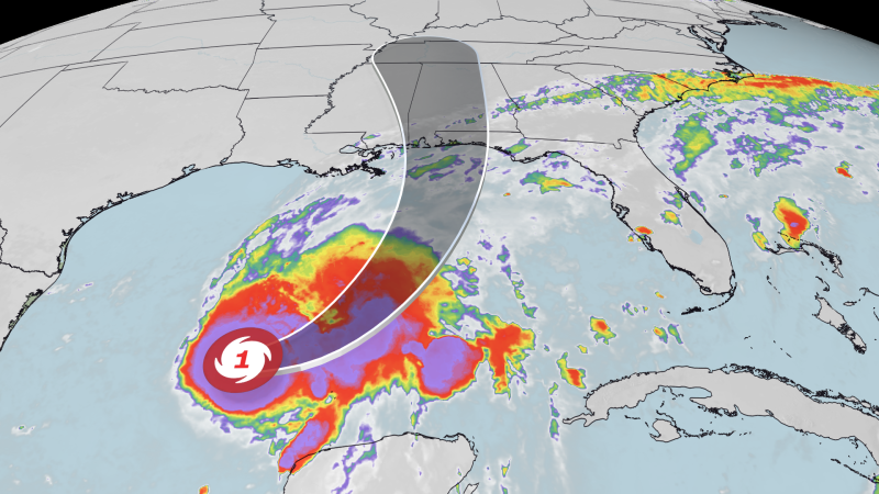
Parts of Alabama, Georgia, the Florida Panhandle, southeastern Louisiana and Mississippi are most at risk from heavy rains from this system. Showers could begin to intensify along the coast as early as Friday, then continue to flood the region while seeping further inland throughout the weekend.
The hardest hit areas could see 3 to 7 inches of rain, with up to 10 inches in localized areas.
Some of the heaviest rain could affect areas from southern Mississippi to the Florida Panhandle. A Level 3 of 4 Flood Rainfall Risk (the purple area in the graphic below) is in effect there Friday. The risk of flash flooding will extend further inland into the southeast on Saturday.
Friday:
SATURDAY:
Tropical storm winds of 39 mph or higher, with higher gusts, could reach the Gulf Coast by Friday evening as Isaias moves toward the coastline. Wind this strong can knock down some trees and cause power outages.
Hurricane-force winds of 74 mph or greater are likely near and just inland from where Isaias makes landfall, but it is still too early to determine exactly where that will occur. The strongest winds will likely hit coastal areas from eastern Louisiana to the Florida Panhandle, depending on the hurricane’s track.
Isaias will become larger as it gets closer to the coast, meaning windy conditions will spread across much of the Southeast later Friday and Saturday.
Storm surge is possible Friday evening, but its severity depends on exactly how strong Isaias is and when it makes landfall. Wave levels will be higher if Isaias lands near high tide.
Isaias could produce tornadoes in its rain bands later Friday night into Saturday. Areas east of the storm center will be at greatest risk from these tornadoes, which are expected to be largely short-lived and on the lower end of the EF scale.
Friday:
SATURDAY:
Gn usa