
Hurricane Polo heads toward Mexico as California braces for dangerous waves and flooding

A massive hurricane is heading toward Mexico as Southern California braces for dangerous waves, powerful rip currents and coastal flooding – with the storm’s huge swells expected to crash onto area beaches.
Hurricane Polo is expected to make landfall Monday in Baja California Sur, according to the National Oceanic and Atmospheric Administration, after exploding into one of the strongest storms on record in the eastern Pacific.
But even though Polo is not expected to directly impact Southern California, its massive wave energy is expected to propagate north toward the coast, with the largest impacts expected for Monday and Tuesday.
Swells are expected to begin arriving Sunday evening, while high tides could reach around 7 feet, increasing the risk of flooding along beaches, walkways and low-lying coastal areas.
The NWS warned that Los Angeles and Ventura counties could experience waves of four to seven feet, as well as strong rip currents, beach erosion and possible coastal flooding when large swells arrive at high tide.
Areas of particular concern include the Long Beach Peninsula, Belmont Shore, Malibu and Avalon, although hazardous conditions could extend across much of the Southern California coast.
The coastline is still recovering from the impacts of Hurricane Marie earlier this month, with powerful swells, high tides and dangerous waves causing widespread erosion and infrastructure damage.
Long Beach, Malibu and other coastal communities experienced flooding, damaged seawalls and significant beach erosion, leaving some areas vulnerable as they continue to deal with the storm’s aftermath.
In Long Beach and Seal Beach, crews reinforced sand berms and prepared for flooding.
At Seal Beach, lifeguard stations were removed from parts of the beach after erosion left some areas with little safe space for equipment.
Long Beach officials also worked to strengthen the sand berm protecting homes along the peninsula and prepare sandbags and pumps in anticipation of expected swells.
“The main concern with this particular system is the significant wave energy, very dangerous waves and large and potentially dangerous or even life-threatening rip currents that will also occur,” NOAA’s Dr. Ariel Cohen told KTLA.
The coastal threat has become so severe that wildlife officials even moved two recently discovered olive ridley sea turtle nests from Seal Beach and Huntington Beach to the Aquarium of the Pacific in Long Beach, citing the combination of high tides and dangerous waves.
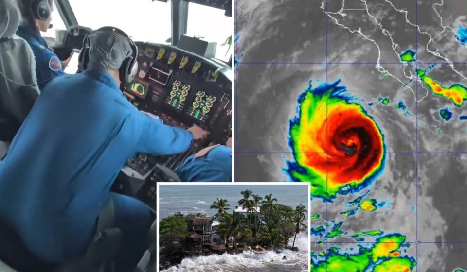
Meanwhile, dramatic footage from inside Polo shows just how powerful the hurricane has become.
Video shared by NOAA’s Hurricane Hunters shows a WP-3D aircraft diving directly through Polo’s violent eyewall.
In the cockpit, the plane can be seen shaking and bouncing violently as the crew heads towards the eye, before the turbulent flight gives way to a strange pocket of calm.
Another view from the flight shows a blue sky surrounded by towering white clouds as the plane emerges into the eye of the hurricane.
Polo had already reached an extraordinary speed of 180 mph, with central pressure dropping to around 892 millibars, placing it among the most intense Eastern Pacific hurricanes ever measured.
Download the California Post app, follow us on social media and subscribe to our newsletters
California Post News: Facebook, Instagram, TikTok, X, YouTube, WhatsApp, LinkedIn
California Post Sports Facebook, Instagram, TikTok, YouTube,
California Post Notice
California Postal Service Newsletters: Register here!
California Post app: Download here!
Home delivery: Register here!
Page Six Hollywood: Register here!
Gn headline