
Two dead as Isaias weakens to post-tropical cyclone after hitting Florida Panhandle | Hurricane Isaiah

Two people died amid Isaias after it made landfall Friday night on the Florida panhandle as a Category 2 hurricane, authorities said.
Both deaths occurred after trees fell on homes, one in Escambia County, Florida, and another in Birmingham, Alabama, as the storm moved inland, local authorities said.
Meanwhile, even though it had weakened to a post-tropical cyclone on Saturday, Isaias still posed threats of flooding and tornadoes as it moved inland, forecasters and officials warned.
Additionally, more than 868,000 customers were without power across Florida, Alabama and Georgia as of Saturday morning as those in the storm’s path began the cleanup process, according to PowerOutage.us.
Although storm surge and tropical storm warnings associated with Isaias have been discontinued, the National Hurricane Center (NHC) warned that there are still likely to be “significant impacts” associated with Isaias across much of southern Alabama, the Florida Panhandle, and southwest Georgia.
“Flash, urban, and riverine flooding is possible throughout the region,” the NHC said in an advisory issued Saturday morning, adding that there was considerable potential for flash flooding and landslides in the southern Appalachian Mountains. “A risk of tornadoes will persist…until (Saturday) afternoon in parts of the eastern Florida Panhandle, Georgia and the Carolinas. »
Isaias through Sunday is expected to produce precipitation amounts of 4 to 8 inches across southern Alabama, the Florida Panhandle and Big Bend areas, and southwest Georgia. Localized totals of up to 15 inches are possible, especially in rain bands across the Florida Panhandle and Big Bend.
Across much of the rest of the Southeastern United States, precipitation amounts of 2 to 5 inches are expected, and higher localized amounts of up to 10 inches are possible, particularly in the southern Appalachians and coastal Carolinas.
Isaias made landfall near Destin, Florida, on Friday as a powerful Category 2 hurricane. It is the first Atlantic hurricane of the season, a late and atypical formation, which hit the U.S. Gulf Coast with heavy rain, strong winds and life-threatening flooding.
The hurricane’s maximum sustained winds were 105 mph (169 km/h) and were forecast to dissipate on Sunday.
Isaias’ winds were so intense they sounded like “a train whistle,” Tim Mowry told The Associated Press after enduring the storm at his home in Pensacola, Florida.
Mowry described losing power Friday afternoon, but said he could rely on a generator. He said his son tried to drive home after a power outage at his home, about 15 minutes away, but had to turn around because downed trees and power lines blocked the road.
All things considered, Mowry said he was “really lucky” in terms of how he fared during Isaias.
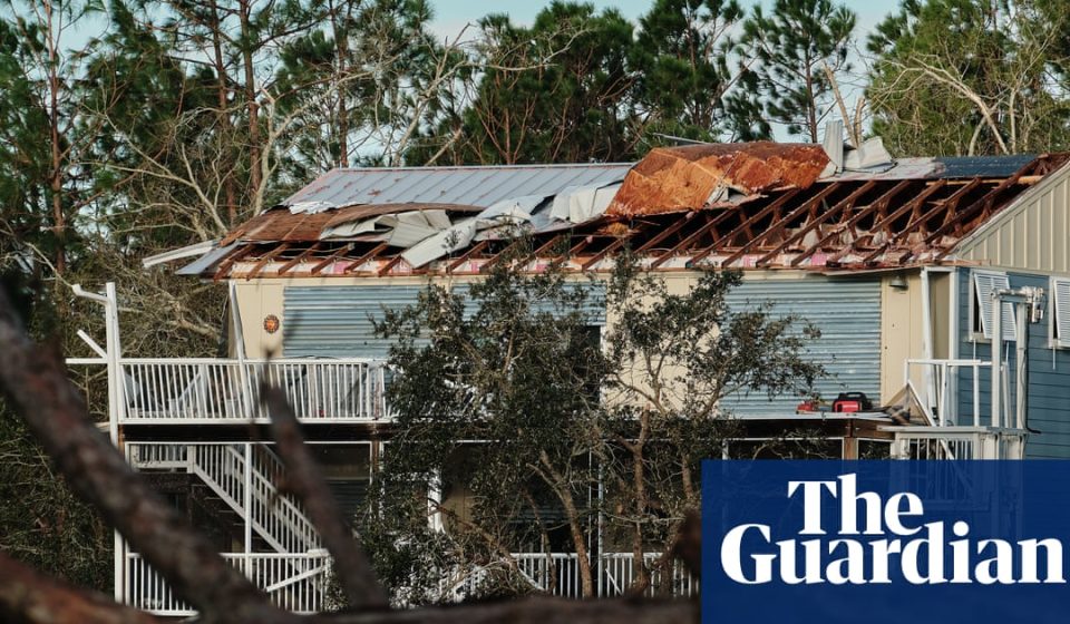
Crestview, Fla., resident Ashley Weeks told news channel WEAR that a tree from her backyard fell on the roof of her home, damaging the roof near her daughter’s bedroom and turning the ceiling into a pile of debris.
It was “just scary — everything, my whole life is in the house,” Weeks said. “We heard a loud noise…like a bomb had gone off in the house. It was so loud. And I got up and I (saw) the tree through the roof, and it was…scary.”
Alabama Governor Kay Ivey warned of “possible drift tornadoes” and asked residents to “prepare for the worst.”
“Right now we are concerned about high winds, heavy rain and possible drifted tornadoes in parts of the state,” Ivey said. “As the weekend approaches and your travel plans begin, make sure you have reliable information as conditions evolve. We hear a lot in emergency management: hope for the best. Prepare for the worst.
“This is the approach we need with this particular storm system.”
Florida Gov. Ron DeSantis said Saturday that crews from Florida’s power plants would spend the day assessing damage, clearing roads and carrying out restoration work.
And while the stronger El Niño appeared to limit the number of Atlantic hurricanes for the year so far, the formation of Isaias in October with maximum sustained winds of 170 km/ha marked a stark contrast to historical trends.
The National Oceanic and Atmospheric Administration (NOAA) predicted a quiet year in terms of hurricanes at the start of a season that officially begins each year on June 1. Noaa predicted between three and six hurricanes, well below the average of seven. An August forecast from Noaa reduced the expected number to between two and six.
Isais is one of the last two Atlantic hurricanes to form, tying a record set on October 8, 1905. Otherwise, the penultimate date for the first Atlantic hurricane was September 11 – in 2002 and 2013.
None of the eight previously named storms of the 2026 Atlantic season intensified beyond tropical storm status.
The Associated Press contributed to this report
Gn headline