
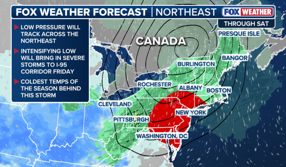

Parts of the Northeast wake up to rain Friday morning, before a severe weather threat develops Friday afternoon, affecting more than 40 million people in Washington, D.C., Baltimore, Philadelphia, New York and Boston.
TAKEAWAYS
- A massive cold front sets the stage for severe storms in major cities across the Northeast.
- More than 40 million people in Washington, D.C., Baltimore, Philadelphia, New York and Boston could experience severe weather.
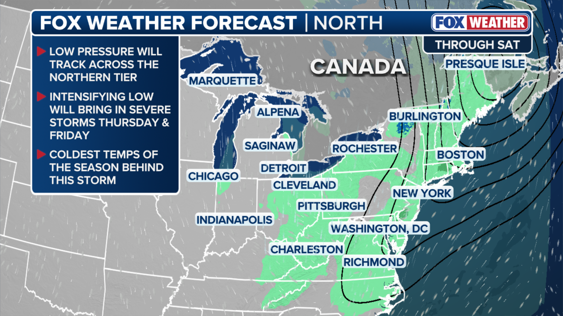
- Behind the storm, the coldest temperatures of the season will arrive Saturday morning, with parts of northern New England waking up to low temperatures in the 30s.
Parts of the Northeast wake up to rain Friday morning, before a severe weather threat develops Friday afternoon, affecting more than 40 million people in Washington, D.C., Baltimore, Philadelphia, New York and Boston.
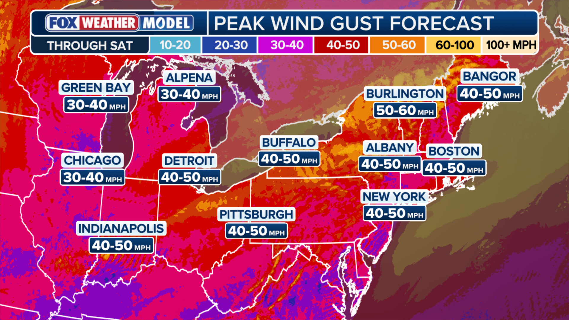
Destructive wind gusts will be the main threat, with the potential for gusts up to 70 mph, especially in eastern Pennsylvania and northern New Jersey, as thunderstorms rumble across the region.
WHAT IS A COLD FRONT?
(FOX Weather)
Behind the storm, conditions will remain windy as the coldest temperatures of the season arrive Saturday morning, with parts of northern New England waking up to low temperatures in the 30s.
SEVERE STORMS THREATEN THE NORTHEAST THIS WEEKEND — WHERE WILL THE HEAVEST RAIN FALL?
The rain is expected to stop by mid-Friday morning, allowing for some daytime warming, leading to more intense thunderstorms in the afternoon.

HOBOKEN, NJ – SEPTEMBER 29: People walk in the middle of a street during a heavy rainstorm on September 29, 2023, in Hoboken, New Jersey. Much of the North East is experiencing severe flooding after heavy rain swept across the region this morning.
(Gary Hershorn/Getty Images)
NOAA has issued a Level 2 out of 5 severe thunderstorm risk for parts of Delmarva, eastern Pennsylvania, New Jersey, the New York metropolitan area, Long Island, the Lower Hudson Valley and southwest Connecticut.
POWERFUL STORM TO CLICK ACROSS THE NORTHEAST WITH RAIN AND DANGEROUS WINDS AHEAD OF FIRST MAJOR FROST OF AUTUMN
“The greatest threat will be high, damaging winds with brief tornado potential that increase this afternoon into early evening,” the FOX Forecast Center said.
The heaviest rain is also expected to arrive on the Interstate 95 corridor toward the evening commute.

(FOX Weather)
The coolest temperatures of the season will arrive Saturday morning behind the massive cold front that brought Friday’s severe weather.
Northern New England will likely experience icy conditions Saturday and Sunday morning, with lows in the 30s.
ANOTHER COASTAL STORM COULD BE PREPARING ON THE EAST COAST WITH POSSIBLE IMPACTS EARLY NEXT WEEK
“Cooler temperatures will allow for some snow at higher elevations Saturday, but this has eased considerably as the low pressure area will not strengthen as much as initially expected,” the FOX Forecast Center said.
(FOX Weather)
By midday Saturday, wind gusts will decrease to around 20 to 30 mph, allowing drier conditions to return.
Even so, light precipitation of 0.5 to 1 inch of rain could continue across the Great Lakes into New England and extend into upstate New York, where totals could be closer to 1 to 2 inches.
South of the Interstate 90 corridor, temperatures will drop into the low 40s Sunday morning.
Gn usa